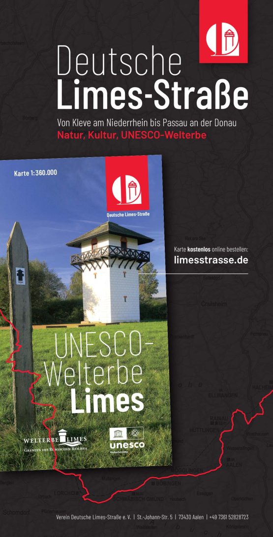
The German Limes Road
The German Limes Road
On the trail of the Romans in Germany
Since July 2021, the entire line of Roman borders in Germany has been a UNESCO World Heritage Site. Since 2005, the Upper Germanic-Raetian Limes, together with Hadrian's Wall and since 2008 with the Antonine Wall, has been the serial transnational World Heritage Site "Borders of the Roman Empire". In 2021, the river boundaries of the Lower Germanic Limes and the western Danube Limes were also added to the UNESCO list as further independent transnational World Heritage Sites. All three World Heritage Sites together now form the only UNESCO World Heritage Sites Cluster "Borders of the Roman Empire", which encompasses the former Roman Empire borders in the United Kingdom, the Netherlands, Germany, Austria and Slovakia and represents one of the most impressive and largest archaeological monuments in Europe. In the Federal Republic of Germany, the three sections of the World Heritage Cluster extend over the five federal states of North Rhine-Westphalia, Rhineland-Palatinate, Hesse, Baden-Württemberg and Bavaria.

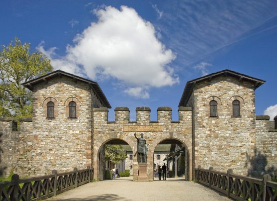
Kastell Weißenburg, Bavaria (c)Scheidt
1000 kilometres of border
The total length of the former Roman borders in Germany is over 1000 kilometres, about half of which are the river borders on the Rhine and Danube and the artificial barriers on land between these two major European rivers.
The Rhine was Rome's first linear external border. The section of the border located here – the Lower Germanic Limes from Katwijk in the Netherlands to Remagen in Rhineland-Palatinate – reflects the complex development processes of the ancient border system in its 450-year history like hardly any other border section of the Imperium Romanum. From the first garrison room for the legions of Augustus, to a system of castles and watchtowers in the 1st century AD, to the fortress bulwark under the late antique emperors.
Like pearls on a string
On the Danube Limes, military installations are strung like pearls on a string. The 222-kilometre-long section of the river in Bavaria between Bad Gögging and Passau formed the first part of the Roman border along the Danube. Here, starting from a series of small forts from the 1st century AD, especially in the late 1st and early 2nd centuries, a sophisticated system of forts, small forts and other infrastructure facilities developed, connected by a road as a communication facility on the south bank of the Danube and with the aim of a closed surveillance of the northern border of the Roman Empire. For topographical reasons, the choice of places was usually made in such a way that, on the one hand, a good overview of the shoreline was possible, and on the other hand, insights into the meandering river as a traffic route could be provided.
Großerlach grave © Schneidt
Roman fort Saalburg © Rothenberger
Rivers - no insurmountable borders
Even though rivers had a natural protective function, they were by no means an insurmountable barrier, at most an obstacle to approach. In addition to the peculiarities of a river border, the Lower Germanic Limes and the Danube Limes are characterised above all by the wide range of military installations: in addition to watchtowers, small forts and auxiliary troop camps – the typical components of Roman border areas – training or marching camps are known, and the legion camps and a fleet camp were also directly integrated into the border security concept.
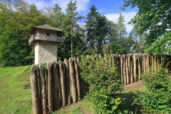
The Upper Germanic-Raetian Limes is the outermost border line in Germania. It is the result of a history of occupation lasting about 200 years, which took place in several stages, the last phase of which resulted in a border with an artificial barrier between the Rhine and the Danube. Already at the beginning of the 2nd century AD, today's course of the Limes in the northwestern section, i.e. in Rhineland-Palatinate and Hesse, was determined, in the south (Baden-Württemberg and Bavaria) the actual Limes line was not reached until a good 60 years later.
Typical here are castles of different sizes with their civil settlements with residential and commercial buildings as well as partly extensive bathing facilities, as well as the Limes towers and the physical barriers themselves. The Upper Germanic Limes from the Rhine to the Rotenbach valley, northwest of Schwäbisch Gmünd, consisted of a rampart and ditch in place of a wooden palisade. In the province of Raetia, from the Rotenbach valley to the Danube near Eining, a continuous stone wall was erected in the last phase of expansion.
There's no better way to get to know a landscape than on foot. The UNESCO World Heritage Limes, which marked the border of the Roman Empire in Germany over a length of over 1000 kilometres, merged with the landscape to form a single entity. Surveillance and barriers (towers, palisades, ditches, forests, walls) formed an artificial border with the troop quarters (forts), the course of which was largely determined by the landscape. If you want to get to know and understand the Limes with its remains, you have to go on a hike.
Travelling the German Limes Road...
The German Limes Cycle Path leads for more than 1100 kilometres past the important Roman stations on the UNESCO World Heritage Limes in Germany. Attractive towns are just along the way as well as well-known spa and recreation centres and picturesque villages. Apart from the numerous Roman attractions, the scenic highlights alternate along the route: from the Lower Rhine, through the cities of Cologne and Bonn, from the Rhine-Westerwald Nature Park through the Lahn Valley, the Taunus, the Wetterau, the Main Valley, the Odenwald, Hohenlohe, the Swabian-Franconian Forest, the Swabian Alb, the Franconian Lake District, the Altmühltal Nature Park and along the Danube to Passau... Get on the saddle and have fun experiencing Roman history.
Whether by car, bike or on foot – you will always find the right card on www.limesstrasse.de . The map data can be downloaded free of charge in the most common file formats.
Along the German Limes Road, the website provides all limes-relevant information on the member towns, museums, tourist information, daily stages or information on the relics of Roman times. A wide range of brochures on tourism on the Limes can also be downloaded free of charge as a PDF document or ordered free of charge in printed form. To do so, please visit the Deutsche Limes-Straße association at: https://www.limesstrasse.de/deutsche-limes-strasse/service/prospekte-und-infos
Layout 1
Memory list for travel planning