Danube Slovakia
Slovak Danube
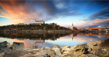
Where the Morava flows into the Danube, the river meets Slovakia and runs - briefly as an Austrian-Slovakian border river - to the capital of the young republic. There, at the foot of Bratislava Castle, the river reaches the Slovakian Danube lowlands (Podunajská rovina) and flows eastward for 172 kilometers as a Slovakian-Hungarian border river. In Slovakia, the Danube dominates the landscape of the southern part of the country - and even if the main course seems short, countless tributaries meander all the longer through the fertile region. Thus, between the Small Danube and the Danube, Europe's largest river island was created: Žitný ostrov (Bulk Island), with a length of 84 and a width of 15 - 30 kilometers. A variety of flora and fauna populate this unique area, rich in forests and meadows, which also scores climatically: due to its exposed position towards the Small Hungarian Plain, this region is one of the warmest and driest in Slovakia. Already in ancient times, the Danube was a crossroads of trade routes, which is also reflected in several Slovak towns along the river: Galanta, Sereď, Komárno (on the Hungarian side: Komaróm) and Nové Zámky alternate with smaller nature reserves until the river completely becomes the Hungarian Danube at a break near Štúrovo (on the Hungarian side: Esztergóm).
The famous waltz by Johann Strauss An der schönen blauen Donau got its name from the largest Central European river. Allegedly, the first bars of the waltz composed in Vienna were written in Bratislava, more than ten years before the work saw the light of day.
The Danube has always been a very important waterway. Already in the 1st century the river became a part of the Roman border known as Limes Romanus, which protected the Empire from Celts and Germanic tribes. Through this waterway allied as well as hostile armies came to the Slovak region, a lot of goods from all corners of the world, but also, for example, German settlers, who helped the country to get a second breath economically after the Tatar plundering. With new settlers, the German-speaking minority in the capital became stronger and stronger. With their royal privileges, the Germans soon rose to become the richest stratum of the population and became the majority that decided the future development and prosperity of the city.
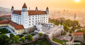
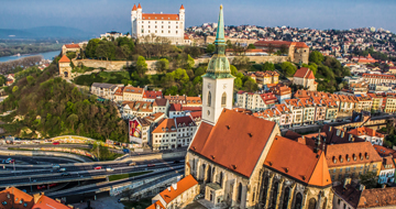
If you look at the old copperplate engravings of Bratislava, the city is mostly depicted from the south side with the Danube and with the castle. In the troubled times of the ever-expanding Ottoman Empire, the river meant invaluable protection for the city. This fact proved to be decisive when the coronation place of Hungarian kings was moved to Bratislava.
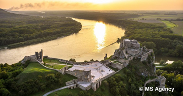
If you want to see the breathtaking confluence of the Danube and Morava rivers, you must visit the 212-meter-high ruins of Thebes Castle (Devín). Also in this place the river forms a natural border with Austria, which was once strictly guarded. The inhabitants of the capital faced the Iron Curtain here during forty years of totality. At this very spot, many tried to cross the river, which is only 40 meters wide - the narrowest part - and escape from the socialist republic to the West. It is no secret that many of them died in the process. The whole zone was guarded by the border guards and the wall was wrapped with barbed wire. Today, on the Danube, there is the Gate to Freedom, which was made of parts of the Wall that were shot to pieces. It commemorates the 400 victims whose attempt to escape ended in tragedy. A few hundred meters further you can find another heart made of barbed wire in the rust color - the Europe Heart, which commemorates the Hainburg march of the people of Bratislava to Austria in December 1989.
