From Map & Compass to Navi, Apps & GPS - The Danube Cartography in the Course of Time
The Danube before Regulation: An Exhibition at the Austrian National Library
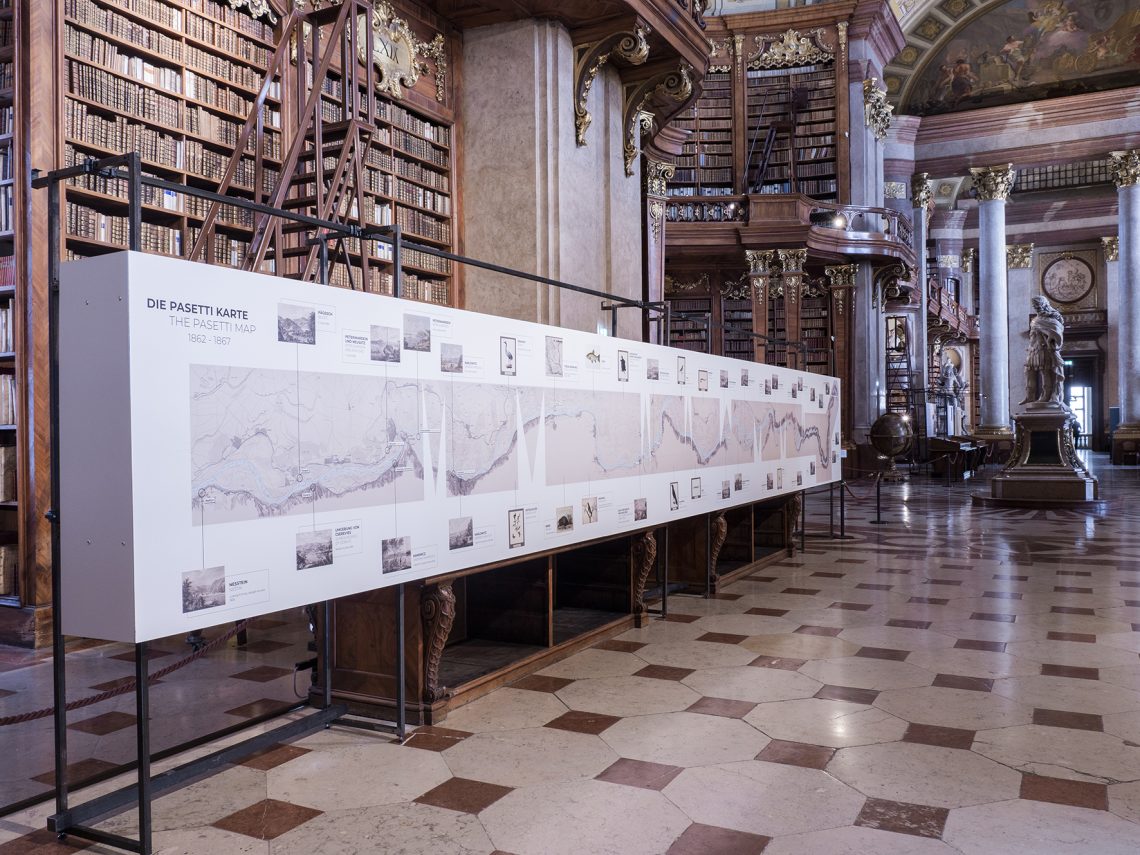
The State Hall of the Austrian National Library in Vienna is not only a highly adequate, but also opulent setting for this worth seeing piece of Danube history: The so-called "Pasetti Map" as a reproduction is enthroned in the meantime of the books, stucco and marble and thus emphasizes in picturesque surroundings its importance of yesteryear: On 44 meters in length, the reproduction of the navigation map from the Danube monarchy shows us what the Danube once was - when it was not yet regulated. Court ministerial official Florian von Pasetti, a hydrotechnician by trade, was commissioned by Emperor Franz Josef to document and map half of the Danube's flow, namely more than 2,800 kilometers between Passau and the later Iron Gate.
The Pasetti Card ©Virgil Widrich OeNB
For the first time in the history of Danube cartography, this river map by the official and expert von Pasetti also documented the hydrographic conditions of the Danube, so the river bottom and its condition were surveyed and recorded as well as the course of the river and the landscape conditions - the map was intended to provide an authoritative basis for the upcoming regulation works. And a little marketing for the upcoming construction work....
As early as the beginning of the 18th century, thought had been given to controlling the dangers of navigation on the Danube by regulating the river. These plans failed due to a lack of funding. Nevertheless, the Danube was the most important supply artery for the imperial capital Vienna - its navigability therefore had the highest priority under Emperor Franz Josef.
The Pasetti Map: Elaborate Cartography and the Wild, Unregulated Danube River of Yesteryear
The "Schifffahrts-Karte der Donau im Bereiche des Österreichischen Kaiserstaates" ("Navigation Map of the Danube in the Area of the Austrian Empire"), which was repeatedly expanded in the years from 1857, was finally a masterpiece and is considered a major work of cartography. More than 150 years ago, a total of 54 maps with a total length of 36 meters were needed to depict the course of the river in the Habsburg Empire. The scale: 1:28,800.
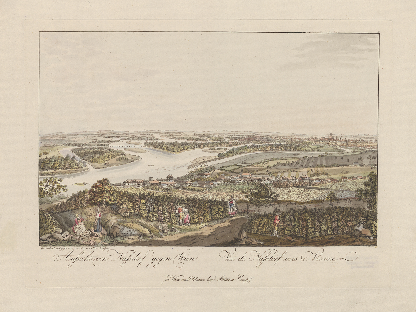
10 countries the Danube flows through today. The show at the Austrian National Library is flanked pictures of "mobile ship bridges", historical objects and other works of art, all of which reflect the importance of the Danube of yesteryear: The Danube is and was a cultural asset, border ("Limes"), transport route, natural landscape, habitat and economic factor. This has not changed since Pasetti's time. But as we see it today on this monstrous and meticulous map work, the Danube is long gone. Then full of rocks, rapids and unimagined dangers such as ice surges and floods, today regulated, built up, tamed and under constant control of its levels.
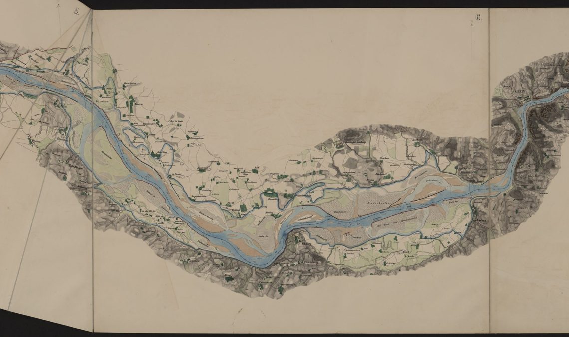
Section of the Pasetti Card ©OeNB
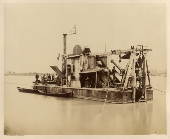
Dredger for Danube regulation ©OeNB
In 1870, ground was broken for the regulation of the Danube in the greater Vienna area - the Pasetti map gives us an overview of the initial situation at that time. It is a reminder of the time before power plants, regulations, cycle paths, flood protection and barrages - when there was still a wildly romantic floodplain at the foot of the Leopoldsberg and Porzellangasse in the 9th district was already under water at times.
When we stand in front of this bundle of maps in the Austrian National Library today, we know one thing for sure: The Danube was like it was in Pasetti's time and long before that, wild and pristine and above all untamed - it will probably never be like that again.
Letters, Reports & Pictures or Google Maps, Route Planner and Apps
Historical guidebooks, picture series, and epistolary travelogues of yesteryear give us a glimpse into the history of the Danube. Today, however, our impressions are dominated by blog stories and online travel guides, route planners, navigation tools and social media apps for on the go. Digitization also comes to our aid for the exhibition at the ÖNB. Pasetti's original maps were digitized and enlarged somewhat. In the original, the map work was a complicated folded volume; for us, it has now been made more readable and "reproduced in a leveled manner" so that we only have to comfortably walk along the meter-long reconstruction, read and study it - at eye level and prepared.
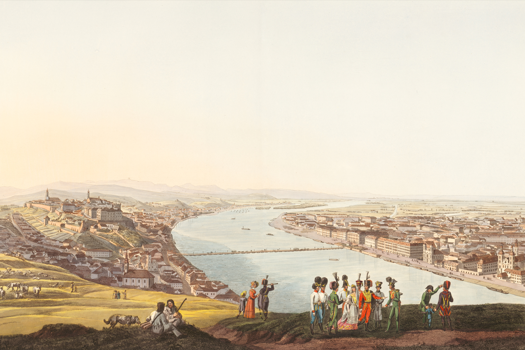
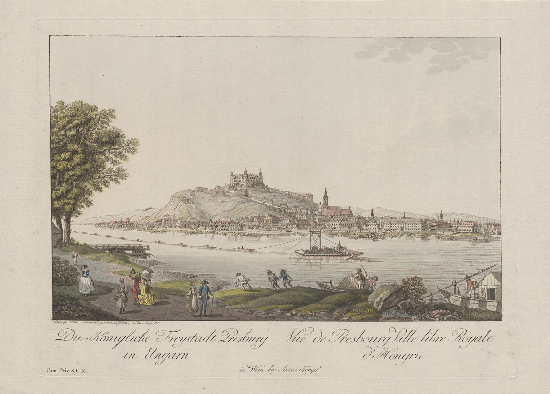
The old picture collections, lithographs and travel reports in the exhibition show again and again impressively how complicated navigation on the Danube (and elsewhere) used to be. Starting in 1820, a certain Adolph Kunike published four editions of a "Mappenwerk", which depicted the course of the Danube in 264 views in lithographs (by Jakob Alt, among others): Some of these can also be examined in the current exhibition of the ÖNB. All pictures can be browsed online - individual sponsorships for the pictures are also possible: such a donation can ensure the restoration of further works of art.
Fords, ferries and flying bridges
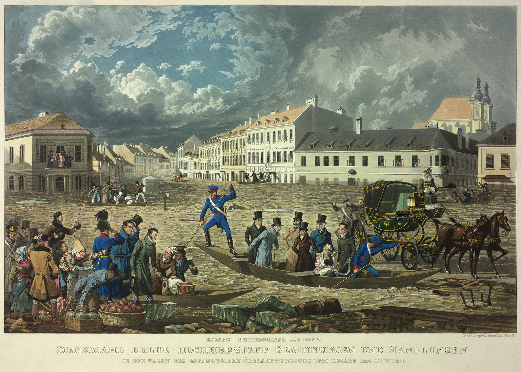
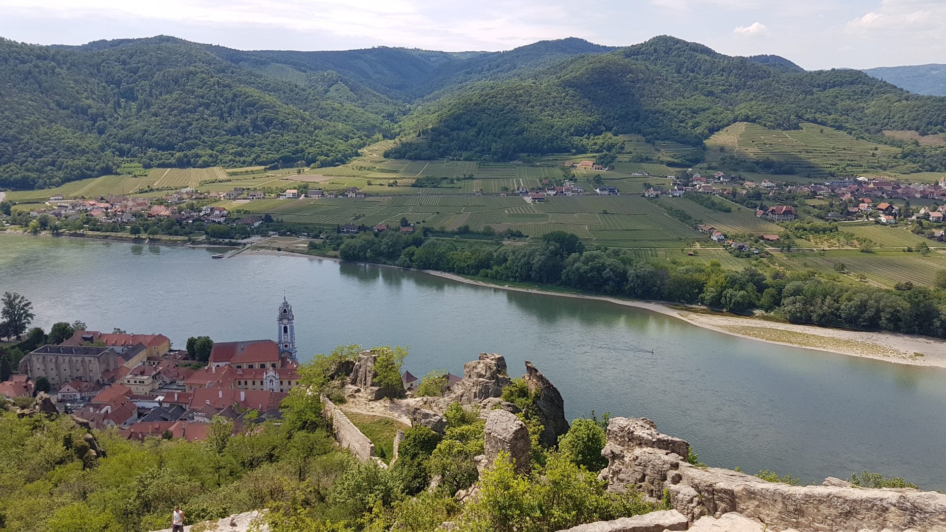
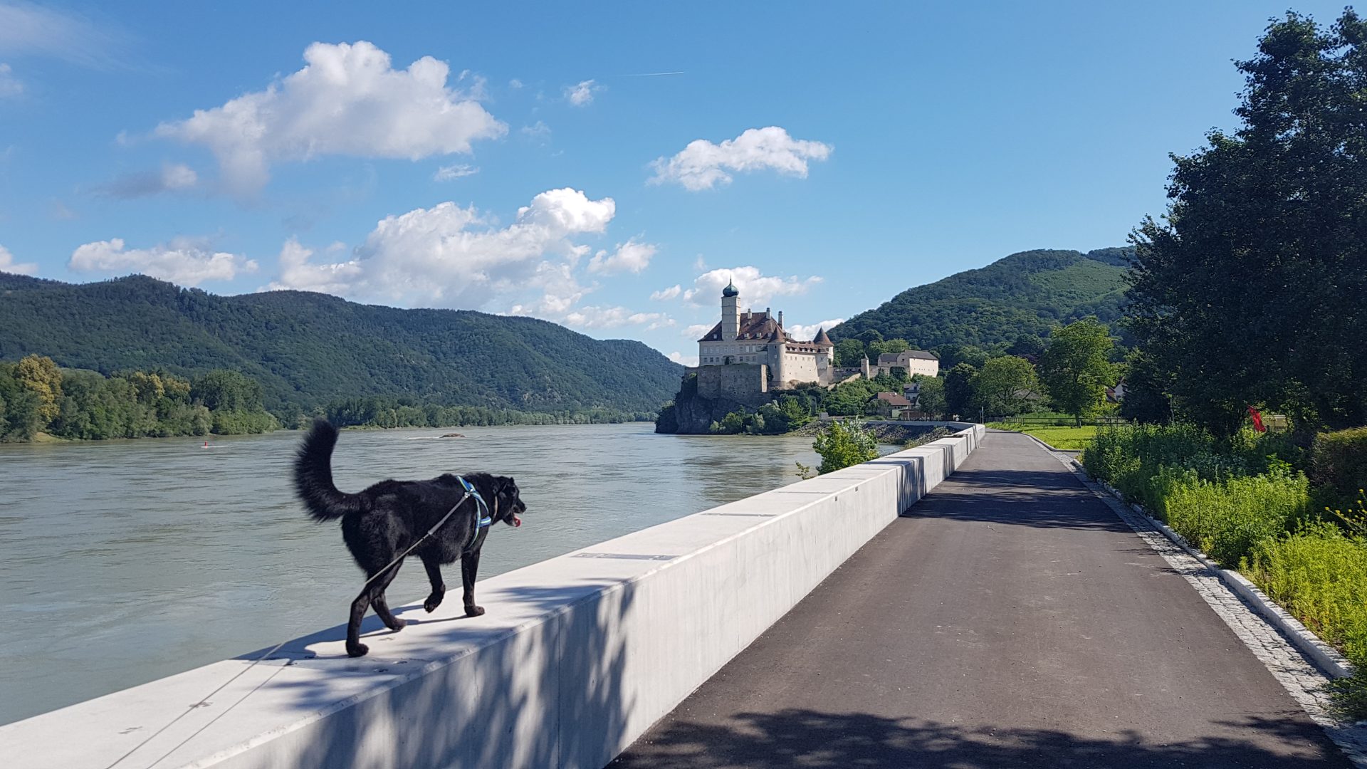
Today, the ferries in the Wachau are a tourist highlight for us on the bike tour, flying bridges no longer exist and with our bathing pontoons and river terraces, one would have probably waved off 150 years ago decidedly and above all appalled: Much too dangerous to voluntarily go so close to the Danube! All too often nowadays we probably also lose the distance to these sometimes hidden, but also obvious dangers: Too much we rely on our "tools" and "apps", our smartphone, our "experiences" from Facebook groups, the ever-ready navi and the GPS. The flood protection in the Wachau, for example at Schönbühel Aggsbach Castle, may not please some people, but it is vital.

The "new maps" of our time are called Komoot, Strava, Google Maps - they give us the illusion of safety, which we should never take for granted, even in the 21st century. Neither when hiking, boating, swimming, nor on a "we're going to look at high water" walk. If you have never learned to read a hiking map with contour lines, you will overlook slopes or river courses even when using Komoot and will be only too happy to rely on the unmanageable range of "online maps". This can be fatal. Common sense and one's own eyes - these are important "tools" that the cartographers of yore knew how to use above all, it seems to me. In addition to their knowledge, experience and many years of study. Such knowledge can never be replaced by Google Maps and smartphone apps: As beautiful as the animated photos and three-dimensionally displayed tours may be... The Danube is never predictable, as much as the digital world, the apps and GPS tools or navigation devices want to tell us.
Tip for a pleasure bike tour, the next walk or walk with the four-legged friend on the Danube: Let's remember how arduous it was here 150 years ago the boats were pulled back upstream by horses on the towpath. If they had not survived anyway only one journey and had been made after arrival long ago to plywood. Who sits in Kritzendorf in the pop-up restaurant directly on the Treppelweg and enjoys Thai food: What did the landscape here look like 200 years ago? Wild and untamed and, above all, dangerous.
And if, during a boat trip with the DDSG, we simply see the river today with the eyes of those people who once regularly put their lives at risk because they neither knew nor were able to assess the dangers of the Danube, nor could they even begin to plan ahead?


More TIPS:
- Become a Danube sponsor of pictures: https://www.onb.ac.at/mieten-foerdern/werden-sie-donau-pate
- Read more: https://www.oepb.at/allerlei/die-donau-der-strom-der-nibelungen-hierzulande-von-passau-bis-hainburg.html
- Online exhibition: https://www.europeana.eu/de/exhibitions/the-danube-connecting-europe/mapping-the-danube
Sources:
- Danube. People, Treasures & Cultures. Exhibition Catalog Schallaburg
- Online archive of the ÖNB, press releases
- Photos: Archive of the ÖNB
Memory list for travel planning